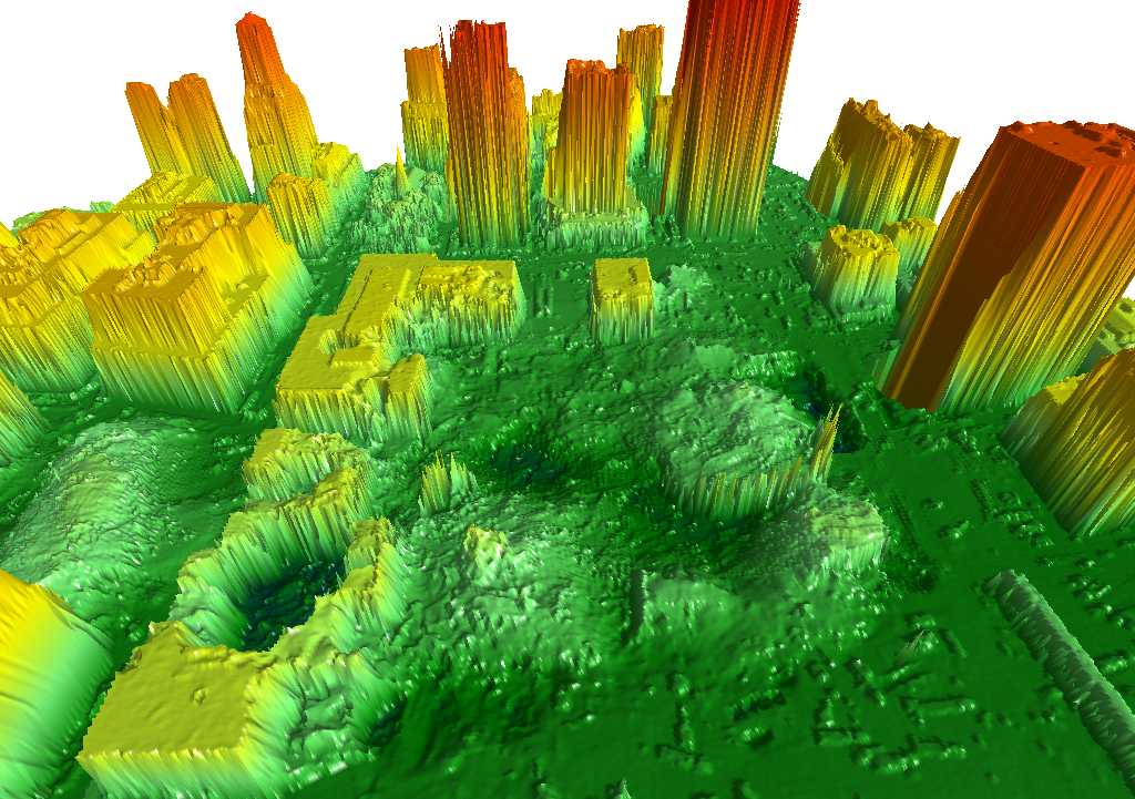
This a LIDAR view, looking east, of the Ground Zero Site. These were made by NOAA to help in the planning of the recovery effort. In this view, the two WTC towers were located in the center of the graphic. In the lower left is 6 WTC, which looks like a crater since the building was crushed from above. At the left edge is a pile of debris that was 7 WTC. The L-shaped building with a flat roof is 5 WTC. In the lower righthand corner of the picture you can see a long, low, thin structure. This is the south pedestrian bridge where many of the photographs on this website were taken.
LIDAR graphics courtesy NOAA